The Colorado Department of Transportation created an excellent video on the Highway of Legends.
Category: <span>Do, See and Explore</span>
Cokedale was a mining camp founded in 1899 by American Smelting and Refining Company (ASARCO) as a company town. The town is now designated on the National Register of Historic Places as the Cokedale Historic District. It’s named for Cokedale for its coke ovens. The remnants can be see on the south side of Hwy 12. These coke ovens were operate at very high temperatures. They turned coal into “coke”, which is a hard coal with the impurities removed. On the north side of the hwy you can see the mountains of slag which is the waste from the process. The mine was shut down in 1947.
Story on Cokedale by 9news. https://www.9news.com/article/travel/destinations/colorado-adventures/9adventures-history-cokedale-colorado/73-e9a71ed5-8e96-4ae9-914a-c2d741b14102
Comments closed
Trinidad Lake has a lot to offer and is just a few miles from town. It was created in 1978 as an irrigation and flood control project. The town of Sopris was flooded to create the lake. The 2,500 acre park has an average average altitude of 6,300 feet. The lake is 800 acres.
There are 9 miles of trails. There are 73 campsites along with picnic areas. Campsites are available for RVs, trailers and tents. There are central water hydrants, electric hookups, flush toilets and showers. There is also a coin operated laundry facility. Group camping and picnicking facilities are also available. There are 10 campsites on the southshore that are non electric.
https://cpw.state.co.us/placestogo/parks/TrinidadLake/Pages/Camping.aspx
Boating is allowed. There are submerged hazards.
Fishing is allowed for rainbow and brown trout, largemouth bass, channel catfish, walleye, crappie and bluegill.
There is a new archery range available https://cpw.state.co.us/placestogo/parks/TrinidadLake/Pages/ArcheryRange.aspx
Need to Know
Swimming is not allowed
Dogs must be on a 6 foot leash.
Comments closed
Fishers Peak is Colorado’s newest State Park! The park is 19,200 acres total. Currently, 250 acres are open. The park includes grasslands, mountains and foothills. Wildlife includes black bears, mountain lions, bobcats, elk and mule deer. There are currently two trails and a drive up picnic area.
The First Look Trail is a quarter-mile professionally designed and built trail through the forest.
A short and easy Discovery Trail leads you to a small meadow. A small loop around the meadow has interpretive signs that allows visitors to learn about the habitat around them.
Fishers Peak is 9,632 feet in elevation. It is higher than any point in North America east of it. Fishers Peak is a national landmark and the most recognizable in southern Colorado. The peak stands over Raton pass which is a mountain pass on the Santa Fe Trail. The pass has been used since the late 1700s.
Hunting opportunities are available. Fine out more here https://cpw.state.co.us/placestogo/parks/FishersPeak
Need to know:
No bikes or dogs/domestic animals are allowed at this time.
Day use only. No camping.
Visitors must stay on trails.
Cost
A park pass is required. https://cpw.state.co.us/buyapply/Pages/ParksPassInfo.aspx
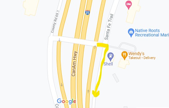
How to get there: Take Exit 11 east to County Road 69-3 (Sante Fe Trail) Travel south until you see the entrance gate and sign on the left.

Comments closed

Comments closed